We combine Earth observation, meteorological, and in-situ data for prediction of soil erosion when strong precipitation is expected. A collaboration between academia, industry, municipalities, and farmers to protect our soils.
The DRAIN project
In the DRAIN project, different technologies are being further developed and integrated to improve the prediction of soil erosion.
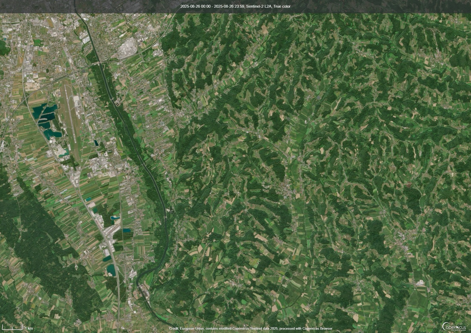
An important source of information is up-to-date land surface data, which are analyzed based on the European Sentinel-2 satellites from the Copernicus Programme. This image shows a Sentinel-2 satellite acquisition from August 2025. It depicts a large-scale landscape with green meadows and forests.
In contrast, an image from October 2025 shows a different picture: many agricultural fields have been harvested and display exposed soil.
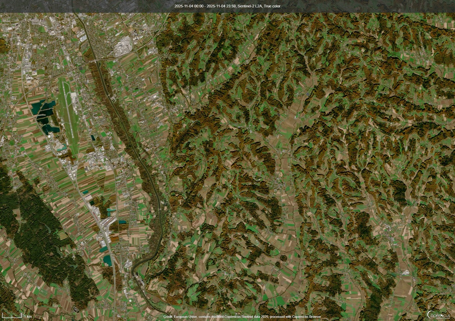
In spring or autumn, these fields are more vulnerable, with heavy rainfall events tending to occur more frequently in spring. In the DRAIN project, these satellite data are analyzed, meteorological forecasting models are improved, enhanced methods for calculating erosion are developed, and, together with farmers, a technical solution for analysis and visualization is being created.
Contribution
All farmers in Austria can contribute and receive the following benefits:
Access to the DRAIN dashboard incl. contribution during the development
Workshops with talks by experts on soil protection
Reimbursement for active participation
Interested? Join the project!
https://www.askallo.com/s/drain_anmeldung
Important! Please always share this original link, not the one that appears in the browser after clicking it.
News
25 March 2026
2nd user workshop in Fernitz-Mellach
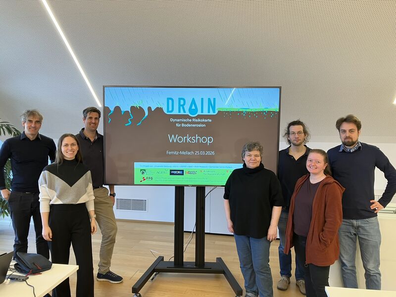
The second user workshop took place on March 25th in Fernitz-Mellach, with participants joining in-person and online. We had a lively and insightful exchange with local farmers, where we presented initial concepts for an integrated dashboard combining weather forecasts, earth observation data, in-situ measurements, and a soil erosion risk monitor.
We are especially grateful for the valuable feedback we received. It will play a key role in shaping the next steps of the project. Farmers across Austria still have the opportunity to get involved.
12 March 2026
Participation and second workshop
Farmers in Austria have the opportunity to participate in the DRAIN project. As a farmer, you know your land best. Through your active participation, you support the development of the digital application with local information directly from the field. This helps us close data gaps and improve our models, which also provides direct benefits to you.
Your participation helps us, but it also offers advantages for you: twice a year there will be workshops focused on soil protection and soil erosion, where experts will be invited to present interesting new developments. During the development phase, you will already receive access to the system as well as to satellite data, meteorological data, and other geospatial data.
Register here to contribute to the project:

03 December 2025
1st user workshop with farmers
A first workshop with local farmers took place in Fernitz-Mellach.
Read on LinkedIn23 October 2025
Kick-off meeting
The kick-off meeting of the DRAIN project took place in Salzburg.
Read on LinkedInConsortium
 A consortium of partners with different expertises work together in the DRAIN project to find the best solutions.
Partners
Department of Geoinformatics - Z_GIS, University of Salzburg
Research partner for geoinformatics and Earth observation.
Visit Z_GISAssociated Partners
BAW (Bundesamt für Wasserwirtschaft)
Funding
FFG
This project is funded by the FFG. The FFG is the central national funding organization and strengthens Austria’s capacity for innovation.
Visit FFGContact
Dr. Martin Sudmanns
Department of Geoinformatics - Z_GIS
5020 Salzburg
Austria
martin.sudmanns [at] plus.ac.at
Let us get in touch!
Legal information
Want to see more about the details? See dedicated page.
Datenschutzerklärung
Weitere Informationen finden Sie in der ausführlichen Datenschutzerklärung.